Good evening all hope you're having a good weekend I'd like to apologise for the somewhat lengthy pause, let's just get right into it...
Contrary to daily star, subpar article Britain is NOT "braced for wettest BONFIRE night ever", it's looking dry with a small chance of an isolated shower with the best chance of clearer skies towards the south and east. Generally poor visibility across north and west.

A rather mild night too only some light layers will be necessary with temperatures expected to be widely in double figures (10-12C) across England and Wales. A far cry from cold nights of recent in which first noticeable low temperatures of season with mercury falling to -6.2C Friday morning in Katesbridge Co Down a notorious "frost hollow". Cold air is less dense and runs off slopes descending and pooling into the valley floor this low lying location being surrounded by hillier terrain makes it a great location for very low temperatures.
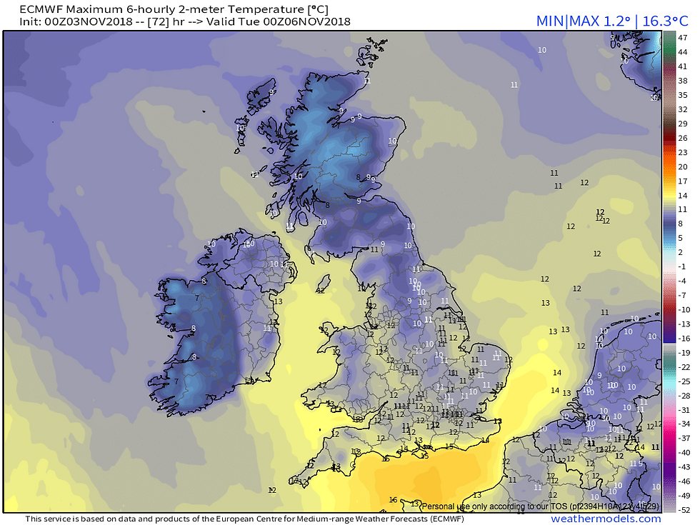
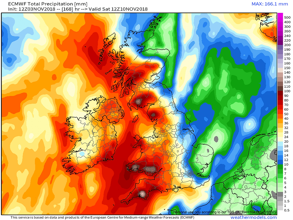
The remainder of the week rather depends on your proximity to Atlantic trough a thoroughly wet week for some albeit rather mild and blustery, as illustrated by this total precipitation ECM precipitation taking us to midday Saturday a large E to W split. Temperatures generally on milder side everywhere 11-16C across England and Wales, temperature range tad cooler elsewhere. With zero chance of frosts a small diurnal range is expected courtesy of cloud cover trapping heat keeping nights unusually mild.
Significant rainfall is expected across large swathes of country; SW, NW England, Wales, much of Scotland, NI & Ireland with over a months worth of rain expected suffice to say you'll need your raincoats, threat of flooding likely stay tuned to Met Office warnings. While east of meridian across the east and southeast a sharp reduction while some rain is likely midweek - it will be much more patchy towards east, these drenching rains held back by Scandinavian block areas further W not so fortunate, while only small amounts are expected in E.
Approaching weekend into following week there is strong agreement for a rise in pressure coming up from S this will bring lighter winds and settled conditions across UK and Ireland.
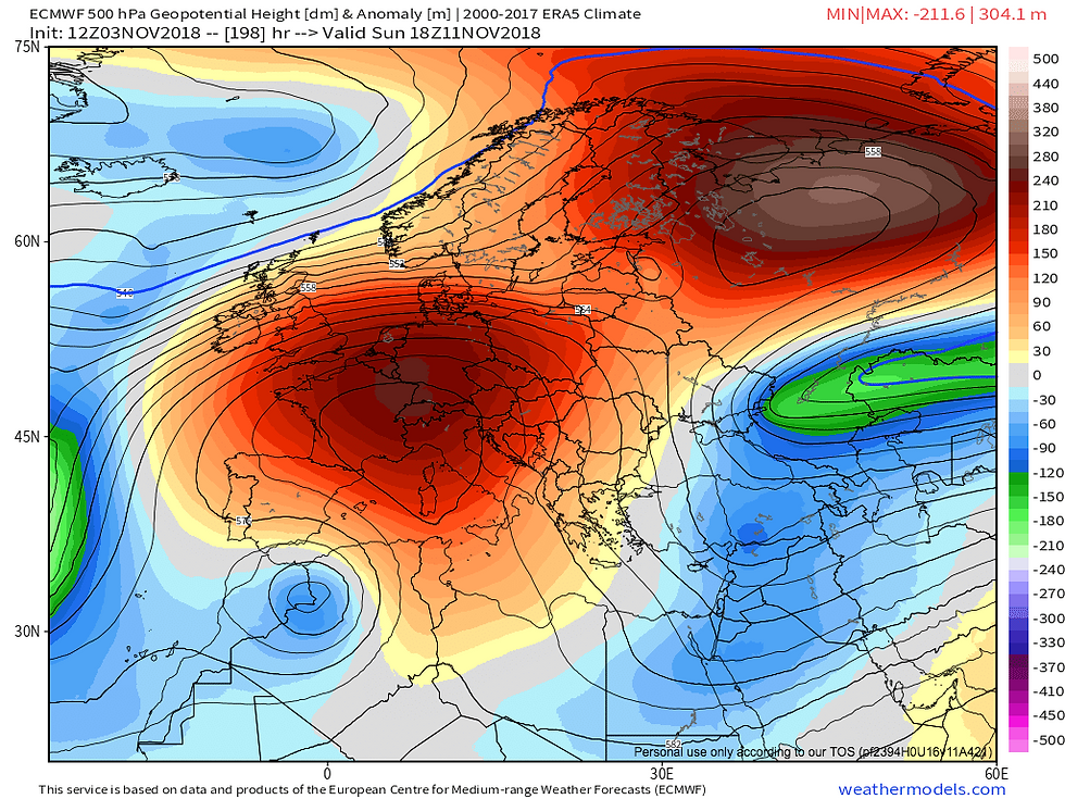
As we head towards mid November I am expecting to see the risk of frost and fog return with crisp sunny days, while there is considerable uncertainty what does appear likely high pressure is likely to hold a great influence on our weather.
These areas blocking are rarely stationary for a long period of time in contrast to summer months where there is little aptitude with a diminished thermal gradient the contrast of cold arctic air and subtropical air often catalyst of disturbed weather in autumn/winter. Dependant on orientation of high pressure cooler winds from northerly or easterly/continental, as witnessed in late October, cold arctic airmass plunged south as HP tugged W in Mid Atlantic. A much cooler airmass cannot be ruled out in late November I am not expecting anything overly significant in next four weeks in terms of wintry weather, nonetheless I am closely watching 'background' developments closely which have aroused my attention as a coldie, will keep you updated when I see appropriate to do so.
Kind regards,
Dan
or that snowdreamer bloke ;-)
Really hope we get snow at Christmas