Monday has began more characteristic of a hot midsummer day particularly across SE England. Heathrow Airport hitting 28.6C making it the hottest day of the year in UK.
However, elsewhere there has been a weakening cold front moving slowly southeastwards which has brought much cooler and cloudier conditions. This cold front will clear through SE tonight so the night will be less warm and humid. Tuesday is expected to be less hot, with highs at best of 25C with high pressure fully in control it will remain dry with plentiful sunny spells across many areas. Although, an approaching frontal system from west will bring cloud, wind and rain to N. Ireland and western and northern parts of Scotland in afternoon.

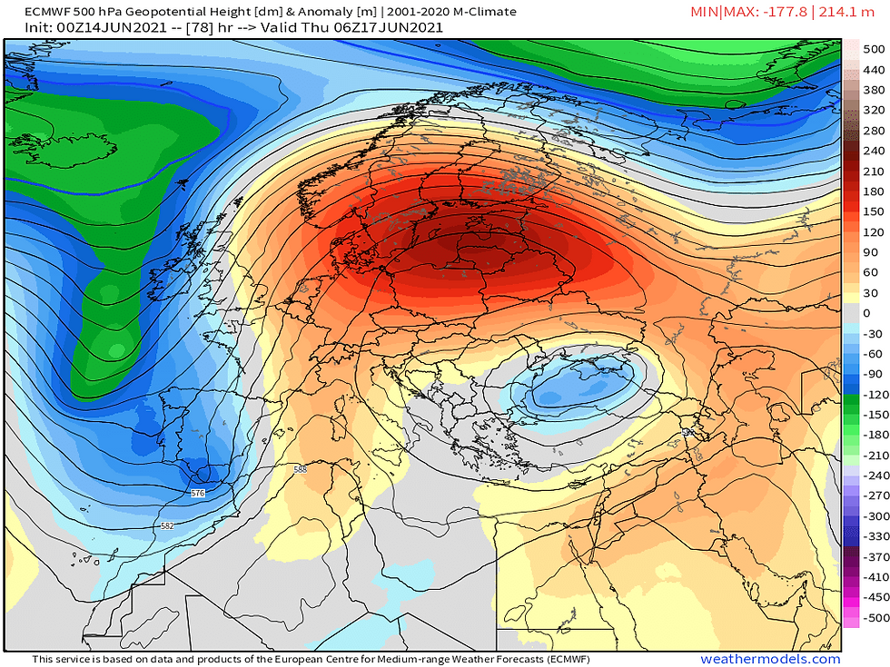
On Wednesday things become interesting a band of rain stalls across parts of Scotland and NW England during morning and dissipates (not that). We see the upper trough in Atlantic essentially an area of low pressure positioned to our northwest being forced and elongated south near Iberian peninsula, by the dome of high pressure in Europe. This helps pull in winds from a southerly direction introducing increasingly hot and humid air.

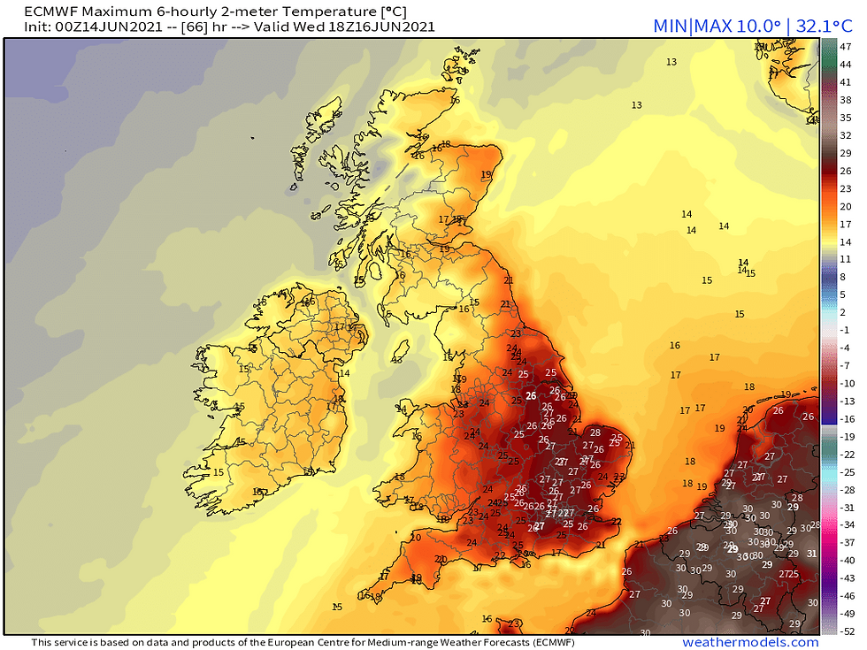
With abundant sunshine across eastern, central, and southern England temperatures will respond with 30C quite likely to be seen in London area.

But later in the day we see increasing instability generated by hot plume and into overnight Thursday we see a thundery low develop in northern France, this will drift north and is likely to bring an area of heavy rain and thunderstorms moving northeast across most of England and perhaps east of Wales most likely into early hours of Thursday.
These storms could contain prolific lightning, biblical rainfall, large hail and strong convective gusts I expect London, SE and East Anglia to have greatest risk of thundery action further west I expect less of a thundery nature more noted for their rainfall.
The humid and warm feel will continue through Thursday across eastern England with potential further thundery rain and elsewhere much fresher with decent sunny spells there could also be some showers most missing them.
On Friday further thundery rain is looking to advance northeast out of France once more largely across SE and East Anglia most areas staying dry and sunny, temperatures returning closer to average for the time of year.
Set to turn more unsettled next weekend, again we see low pressure moving north across France towards SE England the better day Saturday with possible early rain, Sunday a potentially larger area of rain which could impact much of the day.
Some welcome rain is to come following dry weather in recent weeks but perhaps some excessive amounts in places and increased risk of flash flooding owing to 'baked' dry soils. The second half of June is expected to be less settled and perhaps less warm but I anticipate a recovery, overall this June promises to be a solid summer month.
Comments